There are three ways to hike to the abandoned Dawn Mine above Altadena: the first is closed, the second is over-grown, but the third, in a metaphorical bear sense, is just right.
John W. Robinson, in his book “Trails of the Angeles: 100 Hikes in the San Gabriels,†says that Dawn Mine is “the most storied gold prospect in the front range.†But that’s not saying much.
No one has made their fortune from gold in the mountains overlooking the San Gabriel Valley, that doesn’t mean that a bunch of people haven’t tried.
The prospectors started to scratch the surface of Millard Canyon in 1895, and one of those prospectors, Bradford Peck, named the area near the top of the canyon after a friends daughter, Dawn Ehrenfeld.
It wasn’t until 1902 that the real mining began. Michael T. Ryan, an Australian, began the first tunneling into the cliffs on one side of the tiny stream, creating the tunnel that we can still enter.
But he came across one problem. How to carry the tons of ore that needed to be gold-extraction-crushed down the mountain? Hiking the two and a half miles down boulder strewn Millard Canyon was difficult and time consuming. So he forged a trail up the side of the mountain to the Mt. Lowe Railway. Once there he loaded to ore onto the train and it headed down, via the funicular, to extract that beautiful gold.
After Mr. Ryan gave up, realizing that he, like the others, was not going to make his fortune, the mine changed hands many times. In the 1950’s the area became derelict, littered with mining equipment and abandoned shacks.
Over the years they became covered with graffiti and run down. Eventually all were removed except an old engine, which still sits as a marker to the mine entrance.
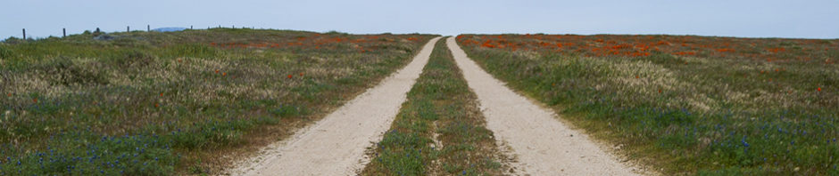
To hike Dawn Mine, drive up the road called Chaney Trail which is closed sunset to sunrise. Chaney Trail tees off West Alta Loma Drive, between Lincoln Ave and Fair Oaks Ave in Altadena.
Chaney Trail is a small winding road that leads up into the San Gabriels. At the end of this road is a car park, don’t park here, because this is the entrance to the closed section of the trail. Park instead at the highest point of Chaney Trail. It’s where the fire road leads up into the mountains. Parking is a problem, because there are so few spaces. It is usually full on weekends, so if you can, go on a weekday, or pray to the parking fairies.
Hike around the fire road barrier, past the water tank and then make a left after 0.4 of a mile, according to my phone, which knows everything. The turn is sign posted for The Sunset Ridge Trail. This trail leads down into Millard Canyon.
Note: There is a fork on this trail, but keep left, down toward the canyon floor.

At 0.4 miles from the beginning of the hike, the Sunset Ridge Trail cuts off from the fire road to head down into Millard Canyon.

The view looking south west from the Sunset Ridge Trail, as it heads down into Millard Canyon.
At 1.05 miles from the car park, the path reaches the gently flowing stream at the bottom of the canyon, which was, in this October 2014 drought, really just a trickle.
The mine is near the top of Millard Canyon, so head upstream, north, away from civilization.
Note: Downstream from here the trail is closed, which leads to the car park you are not supposed to park in, as the forestry service is attempting to rehabilitate it after the Station fire in 2009.
My first attempt to find Dawn Mine was a failure, because I went the wrong way. Although on the plus side, I did come across a stunningly beautiful three tired 40-foot waterfall.
Where I went wrong was not making a right turn, although it is probably worth making the wrong turn just to see the waterfall.
If you do want to see Dawn Mine make a right 1.25 miles from the parking lot. Or to put it another way, make a right 0.2 miles after reaching the stream.
Once making this turn, follow the river another 1.6 miles upstream, or 2.85 miles from the parking lot to the mine itself.
Almost all of this 1.6 miles is hopping over rocks, clambering over boulders, or ducking under fallen trees.
Note: While doing all this hopping, clambering, and ducking, pause for a moment and enjoy the peaceful miles-away-from-the-city burbling stream, scampering squirrels, and bird sounds.

The trail leading up Millard Canyon to Dawn Mine.
From here on out it is practically impossible to get lost, just follow the stream. There are spray-painted arrows along the way, but they are not really necessary, just follow the stream.
Because this is not a well traveled path, a number of the stones are loose so be careful of twisting an ankle, but that is not the only danger.
When the gray cliffs were towering on one side of the valley, there was a huge cracking noise 50 feet ahead. A stone the size of my head had fallen from the cliff face and I heard it bounce on the stones and saw it settle in the stream.
Sitting on a tree limb, near where the stone fell, were two squirrels staring at me and chattering. Because I, of course, can speak to the animals, I will provide you with translation of what one of them was saying: “Damn it Bob! You pushed it too early,” said Stan impatiently and squeakily. “I told you to wait! I get to push it next time, then we get to have hiker for dinner.â€
Because of all the clambering the trail seems longer than it is, but keep going, and then eventually there is an abandoned piece of machinery up to your left. It’s an old engine, with a flywheel attached to each side.
The entrance to the mine is hidden just the other side of the engine.

The only piece of machinery left over from the mining, and also the marker to the entrance to the mine.

The Dawn Mine entrance, on the left behind boulder with an arrow and X-marks-the-spot. The engine visible from the stream bed is off to the right.
On hands and knees, the first view into the mine is what everyone expects when looking into a mine, the classic wooden posts holding up a crosspiece. Although later, thinking about it, this is probably the remains of a door to keep people out, and just the jamb is left. But I could be wrong.
Barring entrance to the cave is a small body of water, people have helpfully thrown in pieces of wood and tree branches to create a slippery unstable walking surface. So I walked, dry footed, across. But I was told by another hiker I met that day, that when he had visited the mine the previous year and had decided to not enter as the water was too deep.
I don’t know if this was because of the drought, but like those signs at amusement park water rides: You Might Get Wet.

The entrance to Dawn Mine. The wood is piled up to create stepping stones over the just visible water. It was easy to cross the puddle, but at other times the water is probably higher, as this was the end of a drought summer.
Thirty feet into the tunnel, just past the pond, is a sandy dry area just perfect for sitting down and contemplating not going further. Two tunnels lead away into darkness and the depths of the mountain, with a large excavated gallery overhead.
The light gray rock is splattered with yellow stone that looks like moss and this reflects in another pond. There are drill holes still waiting for dynamite to be installed.
You will need a flashlight, as the mine is pitch black even so short a distance inside.
I didn’t go any further than this, as mines and underground caves scare the hell out of me, but just this short distance inside it was cool and peaceful, in a I-might-die-from-a-cave-in, sort of way.

Looking straight up into a chunk of removed mountain, with what I can only assume is the one piece of wood that is keeping the whole mountain from falling down.

Water reflecting one of the two passages leading into the mountain inside Dawn Mine.

One of the two passages leading into the mountain inside Dawn Mine.
But remember kids, abandoned mines are dangerous, and while I went alone, a friend knew where I was going, and was waiting for my back-to-civilization text.
Now the facts: Starting elevation: 2000 ft. Ending elevation: 3135 ft. The total time of my hike, from car to car was three and a half hours, with a total of 5.7 miles, all according to my phone.
Millard Canyon is cool and quiet and, when the squirrels aren’t attacking, peaceful. The mine is neat, but the real delight of this hike is the joy of having a place so serene just outside the noise and madness that is Los Angeles.
P.S. I mentioned that there were three ways to reach Dawn Mine, and just for balance sake, here is the over-grown third trail.
The first thing to say is that I don’t recommend this trail, and I have never completed it. It is the trail that the Australian forged from the mine up to the Mt. Lowe Railway.
Start at the same parking place, but instead of turning down into Millard Canyon, follow the tarmacked fire road up the mountain ridge for three miles. Unlike down in the shaded valley, it is in harsh sunlight all the way, and is steeply uphill most of the way, although it is smooth.
After the three miles there is a historic marker, it says that this was a stop of the Mt. Lowe Railway and passengers used to disembark and hike down to Dawn Mine.
I attempted hiking down the trail, but after 50 feet is was almost completely over-grown and difficult to discern, so I left it for someone else, with an adventurous spirit, and a machete.
What a great adventure and essay. Thank you for sharing it. Can you imagine what kind of effort it took to lug all that gear up there and dig a hole into a mountain? And for nothing.